
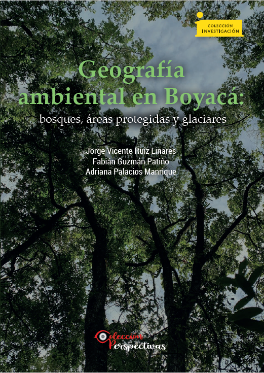
Geografía ambiental en Boyacá: bosques, áreas protegidas y glaciares
Palabras clave:
´´Areas protegidas, Boyacá, Deshielo glaciar, Ecorregiones, Estadística espacial, Índice de Riesgo de la Conservación de BosquesSinopsis
El presente libro consta de cuatro capítulos que abordan la dinámica boscosa y sus conductores, la función de las áreas protegidas en la conservación de los bosques y, finalmente, el deshielo glaciar en el departamento de Boyacá. La dinámica boscosa y sus conductores se estudian inicialmente para 2001-2010 con un sensor de teledetección de resolución espacial grueso como lo es el MODIS. En el Capítulo 2 se estudia tan solo la variación boscosa entre 2009-2015, pero con un sensor de mediana resolución espacial como LANDSAT, además se calculan algunas métricas de ecología del paisaje. Para sorpresa de muchos, Boyacá presentó una ganancia boscosa superior a la deforestación para ambos periodos, aunque en la última ventana de observación esta ganancia boscosa se desaceleró. En el capítulo 3 se examina cuál ha sido el papel de las áreas protegidas a todo nivel, desde las reservas de la sociedad civil, parques municipales y regionales, hasta las áreas protegidas nacionales en el concierto de la protección de la cobertura boscosa. Los resultados son indicativos de ganancia boscosa en todas las ecorregiones presentes en el departamento. Las áreas protegidas nacionales y las reservas de la sociedad civil contribuyeron a conservar la cobertura boscosa, pero no así las áreas protegidas municipales y regionales. Adicionalmente, hubo un aumento de las áreas protegidas a nivel regional y local, que generó una reducción de presión en la cobertura boscosa en los términos de medición del Índice de Riesgo de Conservación de Bosques. El Capítulo 4 estudia el deshielo de la Sierra Nevada del Cocuy y estima que este glaciar, el más grande de Colombia, se extinguirá en su totalidad para mediados del presente siglo si la actual tendencia continúa
Descargas
Los datos de descarga aún no están disponibles.
Referencias
Aide, T. M., Clark, M. L., Grau, R., López-Carr, D., Levy, M. A., Redo, D., Bonilla- Moheno, M., Riner, G., Andrade-Núñez,
M. J., y Muñiz, M. (2013). Deforestation and Reforestation of Latin America and the Caribbean (2001–2010). Biotropica, 45(2), 262–271. https://doi.org/10.1111/j.1744-7429.2012.00908.x Albert, T., Klein, A., Kincaid, J., Huggel, C., Racoviteanu, A., Arnaud,
Y., Silverio, W. y Ceballos, J. (2014). Remote Sensing of Rapidly Diminishing Tropical Glaciers in the Northern Andes. En J. S. Kargel, G. J. Leonard, M. P. Bishop, A. Kääb y B. H. Raup (Eds.), Global Land Ice Measurements from Space (pp. 603–609). Springer. https://doi.org/10.1007/978-3-540-79818-7_26 Álvarez-Berríos, N., Redo, D. J., Aide, T. M., Matthew, L., Clark,
M. L., Grau, R. (2013). Land Change in the Greater Antilles between 2001 and 2010. Land, (2), 81-107. https://doi. org/10.3390/land2020081
An, L. y López-Carr, D. (2011). Understanding Human Decisions in Coupled Natural and Human Systems. Ecological Modelling, (229), 1–4. https://doi.org/10.1016/j.ecolmodel.2011.10.023
Armenteras, D., Cabrera, E., Rodríguez, N., y Retana, J. (2013). National and Regional Determinants of Tropical Deforestation in Colombia. Regional Environmental Change, (13), 1181-1193. https://doi.org/10.1007/s10113-013-0433-7
Armenteras, D., y Retana, J. (2012). Dynamics, Patterns and Causes of Fires in Northwestern Amazonia. PLOS ONE, (7), e35288. https://doi.org/10.1371/journal.pone.0035288
Armenteras, D., Rodríguez, N., Retana, J. y Morales, M. (2011). Understanding Deforestation in Montane and Lowland Forests of the Colombian Andes. Regional Environmental Change, (11), 693- 705. https://doi.org/10.1007/s10113-010-0200-y
ASTER (2017). Advanced Spaceborne Thermal Emission and Reflection Radiomenter. https://asterweb.jpl.nasa.gov/gdem.asp
Barbosa A. P., Galindo G., Vergara L. K., y Cabrera E. (2017). Hoja metodológica del indicador Tasa anual de deforestación, Versión 1,2. Sistema de Indicadores Ambientales de Colombia. Instituto de Hidrología, Meteorología y Estudios Ambientales - IDEAM. Barcaza, G., Nussbaumer, S. U., Tapia, G., Valdés, J., García, J. L.,
Videla, Y., Albornoz, A., y Arias, V. (2017). Glacier Inventory and Recent Glacier Variations in the Andes of Chile, South America. Annals of Glaciolog y, 58(75), 166–180. https://doi. org/10.1017/aog.2017.28 Bedoya-Soto, J. M., Poveda, G., Trenberth, K. E., y Vélez-Upegui, J. J.
(2019). Interannual Hydroclimatic Variability and the 2009–2011 Extreme ENSO Phases in Colombia: from Andean Glaciers to Caribbean Lowlands. Theoretical and Applied Climatolog y, 135(3–4), 1531–1544. https://doi.org/10.1007/s00704-018-2452-2 Bernal, N. R., Cabrera, E., Morales, M., Rincón, A., Ortiz, N.,
Rodríguez, N. (2007). Estado y presión sobre los ecosistemas en las corporaciones autónomas regionales y de desarrollo sostenible: una tipología
Blackman, A., y Veit, P. (2018). Titled Amazon Indigenous Communities Cut Forest Carbon Emissions. Ecological Economics, (153), 56-67. https://doi.org/10.1016/j.ecolecon.2018.06.016
Bocco, G., Urquijo, P. S., y Vieyra, A. (2011). Introducción ¿Para qué una geografía ambiental? En G. Bocco, P. S. Urquijo, y A. Vieyra (Coord.). Geografía y Ambiente en América Latina. Universidad Nacional Autónoma de México, Centro de Investigaciones en Geografía Ambiental.
Breiman, L. (2001). Random Forest. Machine Learning, (45), 5–32. https://doi.org/10.1023/A:1010933404324
Brunsdon, C. F., Fotheringham, A. S., y Charlton, M. E. (1996). Geographically Weighted Regression: a Method for Exploring Spatial Nonstationarity. Geographical Analysis, 28(4), 282-298. https://doi.org/10.1111/j.1538-4632.1996.tb00936.x
Burnham, K. P., y Anderson, D. R. (2013). Model Selection and Multimodel Inference: A Practical Information-Theoretic Approach. Springer.
Burns, P., y Nolin, A. (2014). Using Atmospherically-corrected Landsat Imagery to Measure Glacier Area Change in the Cordillera Blanca, Peru from 1987 to 2010. Remote Sensing of Environment, (140), 165–178. https://doi.org/10.1016/j.rse.2013.08.026 Cabrera E., Vargas D. M., Galindo G., García, M.C., Ordóñez, M. F.
(2011). Memoria técnica de la cuantificación de la deforestación histórica nacional – escalas gruesa y fina. Instituto de Hidrología, Meteorología y Estudios Ambientales - IDEAM.
Castiblanco, C., Etter, A., Aide, T. M. (2013). Oil Palm Plantations in Colombia: a Model of Future Expansion. Environmental Science Policy, (27), 172-183. https://doi.org/10.1016/j.envsci.2013.01.003 Castro-Núñez, A., Mertz, O., Buritica, A., Sosa, C. C., y Lee S. T.
(2017). Land Related Grievances Shape Tropical Forest-Cover in Areas Affected by Armed-Conflict. Applied Geography, (85), 39-50. https://doi.org/10.1016/j.apgeog.2017.05.007 Ceballos, J. L., Euscátegui, C., Ramírez, J., Cañón, M., Huggel, C.,
Haeberli, W., y Machguth, H. (2006). Fast shrinkage of tropical glaciers in Colombia, Annals of Glaciolog y, (43), 194-201. https:// doi.org/10.3189/172756406781812429
Chadid, M., Dávalos, L. M., Molina, J., y Armenteras, D. (2015). A Bayesian Spatial Model Highlights Distinct Dynamics in Deforestation from Coca and Pastures in an Andean Biodiversity Hotspot. Forests, (6), 3828-3846. https://doi.org/10.3390/f6113828 Chazdon, R. L., Broadbent, E. N., Rozendaal, D. M., Bongers, F., Zambrano, A. M., Aide, T. M., Balvanera, P., Becknell, J. M., Boukili, V., Brancalion, P. H., Craven, D., Almeida-Cortez, J. S., Cabral, G. A., de Jong, B., Denslow, J. S., Dent, D. H., DeWalt, S. J., Dupuy, J. M., Durán, S. M., Espírito-Santo, M., … Poorter, L.
(2016). Carbon Sequestration Potential of Second-growth Forest Regeneration in the Latin American Tropics. Science Advances, 2(5). https://doi.org/10.1126/sciadv.1501639
Clark, M. L., Aide, T. M., Grau, H. R., y Riner, G. (2010). A Scalable Approach to Mapping Annual Land-cover at 250-m Using MODIS Time Series Data: A Case Study in the Dry Chaco Ecoregion of South America. Remote Sensing of Environment, (114), 2816–2832. https://doi.org/10.1016/j.rse.2010.07.001
Clark, M. L., Aide, T. M., y Riner, G. (2012). Land Change for all Municipalities in Latin America and the Caribbean Assessed from 250-m MODIS Imagery (2001–2010). Remote Sensing of Environment, (126), 84-103. https://doi.org/10.1016/j. rse.2012.08.013
Clark, M. L., y Aide, T. M. (2011). An Analysis of Decadal Land Change in Latin America and the Caribbean Mapped from 250–m MODIS Data. [Conferencia]. 34th International Symposium on Remote Sensing of Environment. Sydney, Australia.
Clark, M., Ruiz, J., Fandino, M. C., y López-Carr, D. (2021). Conservation Priorities in Terrestrial Protected Areas for Latin America and the Caribbean Based on an Ecoregional Analysis of Woody Vegetation Change, 2001-2010. Land, (10), 1067, 1-21. https://doi.org/10.3390/land10101067
Cunningham, D., y Cunningham, P., Fagan, M. (2020). Evaluating Forest Cover and Fragmentation in Costa Rica with a Corrected Global Tree Cover Map. Remote Sensing, 12(19), 1-33. https://doi. org/10.3390/rs12193226
Departamento Administrativo Nacional de Estadística (2015). Estimaciones y Proyecciones de Población. http://www.dane.gov.co/ index.php/poblacion-y-demografia/proyecciones-de-poblacion Dussaillant, I., Berthier, E., Brun, F., Masiokas, M., Hugonnet, R.,
Favier, A., Rabatel, A., Pitte, P., y Ruiz, L. (2019). Two decades of glacier mass loss along the Andes. Nature Geoscience, 12, 802–808. https://doi.org/10.1038/s41561-019-0432-5
Duque, J. C., Velásquez, H., y Agudelo, J. (2011). Infraestructura pública y precios de vivienda: una aplicación de regresión geográficamente ponderada en el contexto de precios hedónicos. Ecos de Economía, 15(33), 95-122. https://www.redalyc.org/articulo. oa?id=329027268005
Ellis, E., Baerenklau, K., Marcos-Martínez, R., y Chávez, E. (2010). Land Use/Land Cover Change Dynamics and Drivers in a Low-grade Marginal Coffee Growing Region of Veracruz, Mexico. Agroforestry Systems, (80), 61–84. https://doi.org/10.1007/ s10457-010-9339-2 Etter, A., McAlpine, C., Phinn, S., Pullar, D., y Possingham, H.
(2006a). Characterizing a Tropical Deforestation Wave: a Dynamic Spatial Analysis of a Deforestation Hotspot in the Colombian Amazon. Global Change Biolog y, 12(8), 1409–1420. https://doi.org/10.1111/j.1365-2486.2006.01168.x Etter, A., McAlpine, C., Phinn, S., Pullar, D., y Possingham, H.
(2006b). Unplanned Land Clearing of Colombian Rainforests: Spreading like Disease? Landscape and Urban Planning, 77(3), 240–254. https://doi.org/10.1016/j.landurbplan.2005.03.002
Etter, A., McAlpine, C., Pullar, D., y Possingham, H. (2006c). Modelling the Conversion of Colombian Lowland Ecosystems since 1940: Drivers, Patterns and Rates. Journal of Environmental Management, 79(1), 74–87. https://doi.org/10.1016/j.jenv man.2005.05.017
Etter, A., McAlpine, C., y Possingham, H. (2008). Historical Patterns and Drivers of Landscape Change in Colombia since 1500: A Regionalized Spatial Approach. Annals of the Association of American Geographers, 98(1), 2-23. https://doi. org/10.1080/00045600701733911
Etter, A., y van Wyngaarden, W. (2000). Patterns of Landscape Transformation in Colombia, with Emphasis in the Andean Region. AMBIO: A Journal of the Human Environment, 29(7), 432–439. https://doi.org/10.1579/0044-7447-29.7.432 Food and Agriculture Organization of the United Nations −FAO−.
(2020). Global Forest Resources Assessment 2020. FAO. https://doi. org/10.4060/ca9825en
Favier, V., Wagnon, P., y Ribstein, P. (2004). Glaciers of the outer and inner tropics: A different behaviour but a common response to climatic forcing. Geophysical Research Letters, 31(16), 1-5. https:// doi.org/10.1029/2004GL020654
Flórez, A. (1992). Los nevados de Colombia: Glaciales y glaciaciones. Análisis Geográficos, 22. Instituto Geográfico Agustín Codazzi. Foley, J. A., Defries, R., Asner, G. P., Barford, C., Bonan, G., Carpenter, S.R., Chapin, F. S., Coe, M. T., Daily, G. C., Gibbs, H. K., Helkowski, J. H., Holloway, T., Howard, E. A., Kucharik, C. J., Monfreda, C., Patz, J. A., Prentice, I. C., Ramankutty, N.
y Snyder, P. K. (2005). Global consequences of land use. Science,
309 (5734), 570-574. https://doi.org/10.1126/science.1111772
Fotheringham, A., Brunsdon C., y Charlton, M. (2002). Geographically Weighted Regression. Wiley.
Gagliasso, D., Hummel, S., y Temesgen, H. (2014). A Comparison of Selected Parametric and Non-Parametric Imputation Methods for Estimating Forest Biomass and Basal Area. Open Journal of Forestry, 4(1), 42-48. https://doi.org/10.4236/ojf.2014.41008 Galindo G., Espejo O. J., Ramírez J. P., Forero C., Valbuena C. A., Rubiano J. C., Lozano R. H., Vargas K. M., Palacios A., Palacios S., Franco C. A., Granados E. I., Vergara L. K., y Cabrera
E. (2014). Memoria técnica de la Cuantificación de la superficie de bosque natural y deforestación a nivel nacional. Actualización Periodo 2012 – 2013. Instituto de Hidrología, Meteorología y Estudios Ambientales – IDEAM.
Ganzenmüller, R., Sylvester, J. M., y Castro-Nunez, A. (2022). What Peace Means for Deforestation: An Analysis of Local Deforestation Dynamics in Times of Conflict and Peace in Colombia. Frontiers in Environmental Science. https://doi. org/10.3389/fenvs.2022.803368 Geldman, J., Barnes, M., Coad, L., Craigie, I. D., y Burgess, N. D.
(2013). Effectiveness of Terrestrial Protected Areas in Reducing Habitat Loss and Population Declines. Biological Conservation, 161, 230-238. https://doi.org/10.1016/j.biocon.2013.02.018
Gómez-Ruiz, P. A., Lindig-Cisnerosa, R., y Vargas-Ríos, O. (2013). Facilitation among Plants: A Strategy for the Ecological Restoration of the High-Andean Forest (Bogotá, D.C.— Colombia). Ecological Engineering, 57, 267–275. https://doi. org/10.1016/j.ecoleng.2013.04.049
Graesser, J., Aide, M., Grau, R., y Ramankutty, N. (2015). Cropland/ pastureland dynamics and the slowdown of deforestation in Latin America. Environmental Research Letters, 10(3). http://dx.doi. org/10.1088/1748-9326/10/3/034017
Griffith, D. A. (1987). Spatial Autocorrelation: A primer. Assn of Amer Geographers.
Grubesic, T. H., Wei, R., y Murray, A. T. (2014). Spatial Clustering Overview and Comparison: Accuracy, Sensitivity, and Computational Expense. Annals of the Association of American Geographers, 104(6), 1134-1155. https://doi.org/10.1080/000 45608.2014.958389
Guillen, J., Santiago, J., y Soria, M. (2004). Estudio multitemporal del retroceso glaciar a través de imágenes de sensores remotos y SIG en la Sierra Nevada del Cocuy, Cordillera Oriental de Colombia para el periodo 1960- 2003. [Trabajo de grado, Universidad Distrital Francisco José de Caldas- IGAC].
Herrera, G., y Ruiz, J. (2008). Retroceso glaciar en la Sierra Nevada del Cocuy, Boyacá - Colombia, 1986-2007. Perspectiva Geográfica (13), 27–36. https://doi.org/10.19053/01233769.1710
Hoekstra, J. M., Boucher, T. M., Ricketts, T. H., Roberts, C. (2004). Confronting a Biome Crisis: Global Disparities of Habitat Loss and Protection. Ecolog y Letters, (8), 23–29, https://doi. org/10.1111/j.1461-0248.2004.00686.x
Hoffmann C., Garcia, J. R., y Kruger, T. (2018). A local perspective on drivers and measures to slow deforestation in the Andean- Amazonian foothills of Colombia. Land Use Policy, 77, 377-391. https://doi.org/10.1016/j.landusepol.2018.04.043 Huete, A., Didan, K., Miura, T., Rodriguez, E. P. Gao X., y Ferreira,
L. G. (2002). Overview of the Radiometric and Biophysical Performance of the MODIS Vegetation Indices. Remote Sensing of Environment, 83(1-2), 195–213. https://doi.org/10.1016/ S0034-4257(02)00096-2
Instituto de Hidrología, Meteorología y Estudios Ambientales (2017). Tasa anual de deforestación según departamento. IDEAM. http://www. ideam.gov.co/web/ecosistemas/ecosistemas-recursos-forestales
Jarque, C. M., y Bera, A. K. (1987). A Test for Normality of Observations and Regression Residuals. International Statistical Review, 55(2), 163-172. https://doi.org/10.2307/1403192
Kaser, G. (1999). A Review of Modern Fluctuations of Tropical Glaciers. Global and Planetary Change, 22(1-4), 93–103. https://doi. org/10.1016/S0921-8181(99)00028-4
Labosier, C. F. (2019). The Integrative Nature of Geography: Bridging the Gap in the Environmental Science Curriculum. International Journal of Applied Geospatial Research, 10(2), 39-46. https://doi. org/10.4018/IJAGR.2019040104
Liaw, A., y Wiener, M. (2002). Classification and regression by randomForest. R News, 2(3), 18–22.
Lino, A., Fonseca, C., Rojas, D., Fischer, E., y Ramos, M. J. (2018). A Meta-analysis of the Effects of Habitat Loss and Fragmentation on Genetic Diversity in Mammals. Mammal Biolog y, (94), 69-76. https://doi.org/10.1016/j.mambio.2018.09.006 Liu, J., Dietz, T., Carpenter, S. R., Alberti, M., Folke, C., Moran, E. Pell, A. N., Deadman, P., Kratz, T., Lubchenco, J., Ostrom, E., Ouyang, Z., Provencher, W., Redman, C. L., Schneider, S. H., y Taylor, W. W. (2007 A). Complexity of Coupled Human
and Natural Systems. Science, 317(5844), 1513-1516. https://doi. org/10.1126/science.1144004 Liu, J., Dietz, T., Carpenter, S., Folke, C., Alberti, M., Redman, C., Schneider, S., Ostrom, E., Pell, A., Lubchenco, J., Taylor, W., Ouyang, Z., Deadman, P., Kratz, T., y Provencher, W. (2007 B). Coupled Human and Natural Systems. AMBIO: A Journal of the Human Environment, 36(8), 639-649. https://doi. org/10.1579/0044-7447(2007)36%5b639:CHANS%5d2.0.CO;2 Loaiza, W., Carvajal-Escobar, Y., de Souza, R. V. A., Kayano, M. T., y
López, N. G. (2020). Spatio-temporal Analysis of the Droughts in Cali, Colombia and their Primary Relationships with the El Nino-Southern Oscillation (ENSO) between 1971 and 2011. Atmósfera, 33(1), 51–69. https://doi.org/10.20937/ATM.52639 McAlpine, C. A., Etter, A., Fearnside, P., Seabrook, L., y Laurance,
W. (2009). Increasing World Consumption of Beef as a Driver of Regional and Global Change: A Call for Policy Action Based on Evidence from Queensland (Australia), Colombia, and Brazil. Global Environmental Change, 19(1), 21-33. https://doi.org/10.1016/j. gloenvcha.2008.10.008
McGarigal, K. (2015). Fragstats Help. Department of Enivornmental Conservation, University of Massachusetts. http://www.umass. edu/landeco/research/fragstats/documents/fragstats.help.4.2.pdf
Morris, J. N., Poole, A. J., y Klein, A. G. (2006). Retreat of Tropical Glaciers in Colombia and Venezuela from 1984 to 2004 as Measured from ASTER and Landsat Images. Proceedings of the 63rd Eastern Snow Conference. pp. 180-191.
Muñoz-Gómez, F. A., Galicia-Sarmiento, L., y Pérez, H. (2018). Agricultura migratoria conductor del cambio de uso del suelo de ecosistemas alto-andinos de Colombia. Biotecnología en el Sector Agropecuario y Agroindustrial, 16(1), 15-25. https://revistas.unicauca. edu.co/index.php/biotecnologia/article/view/1131
Murad, C. A. y Pierce, J. (2018). Landsat Study of Deforestation in the Amazon Region of Colombia: Departments of Caquetá and Putumayo. Remote Sensing Applications: Society and Environment, 11, 161–171. https://doi.org/10.1016/j.rsase.2018.07.003
Naveh, Z. (2007). Landscape Ecology and Sustainabil ity. Landscape Ecolog y, (22), 1437–1440. https://doi.org/10.1007/ s10980-007-9171-x
Nelson, N., y Durschinger, L. (2015). Supporting Zero Deforestation Cattle in Colombia. USAID Supported Forest Carbon, Markets, and Communities Program. Nussbaumer, S. U., Hoelzle, M., Hüsler, F., Huggel, C., Salzmann, N.,
y Zemp, M. (2017). Glacier Monitoring and Capacity Building: Important Ingredients for Sustainable Mountain Development. Mountain Research and Development, 37(1), 141–152. https://doi. org/10.1659/mrd-journal-d-15-00038.1 Olson, D. M., Dinerstein, E., Wikramanayake, E. D., Burgess, N. D., Powell, G. V. N., Underwood, E. C., D’Amico, J. A., Itoua, I., Strand, H. E., Morrison, J. C., Loucks, C. J., Allnutt, T. F., Ricketts, T. H., Kura, Y., Lamoreux, J. F., Wettengel, W. W.,
Hedao, P. y Kassem, K. R. (2001). Terrestrial Ecoregions of the World: a New Map of Life on Earth. Bioscience, (51):
933–938. https://doi.org/10.1641/0006-3568(2001)051%5b0933:- TEOTWA%5d2.0.CO;2
Orrego, S. A. (2011). Economic Modeling of Tropical Deforestation in Antioquia (Colombia), 1980-2000: An Analysis at a Semi-Fine Scale with Spatially Explicit Data. Proquest, UMI Dissertation Publishing.
Overmars, K. P. y Verburg, P. H. (2006). Multilevel Modeling of Land Use from Field to Village Level in the Phillipines. Agricultural Systems, (89), 435–456. https://doi.org/10.1016/j.agsy.2005.10.006
Palfey, R., Oldekop, J. A., Holmes, G. (2022). Privately protected areas increase global protected area coverage and connectivity. Nature Ecolog y and Evolution 6(1-8). https://doi.org/10.1038/ s41559-022-01715-0
PCI Geomatics. (2019). ATCOR Calculate Atmospheric and Terrain Correction. PCI Geomatics.
Peña, J. C. (2015). Análisis multitemporal del retroceso glaciar de la Sierra Nevada del Cocuy ubicada en los departamentos de Boyacá y Arauca entre los años 1992, 2003 y 2014. [Trabajo de grado de Especialización, Universidad Militar Nueva Granada]. http://hdl.handle. net/10654/13551
Pereira, H. M., Navarro, L .M., y Martins, I. S. (2012). Global Biodiversity Change: The Bag, the Good and the Unknown. Annual Review of Environment and Resources, 37, 25-50. https://doi. org/10.1146/annurev-environ-042911-093511 Poorter, L., Bongers, F., Aide, T., Almeyda Zambrano, A., Balvanera, P., Becknell, J., Boukili, V., Brancalion, P., Broadbent, E., Chazdon, R., Craven, D., De Almeida-Cortez, J., Cabral, G., De Jong, B., Denslow, J., Dent, D., DeWalt, S., Dupuy, J., Durán, S.,
Espírito-Santo, M., … Rozendaal, D. (2016). Biomass Resilience of Neotropical Secondary Forests. Nature, (530), 211-214. https:// doi.org/10.1038/nature16512 Portillo-Quintero, C. A., Sánchez, A. M., Valbuena, C. A., González,
Y. Y., y Larreal, J. T. (2012). Forest Cover and Deforestation Patterns in the Northern Andes (Lake Maracaibo Basin): A Synoptic Assessment Using MODIS and Landsat Imagery. Applied Geography,
Poveda, G., y Pineda, K. (2009). Reassessment of Colombia’s Tropical Glaciers Retreat Rates: Are they Bound to Disappear During the 2010-2020 decade? Advances in Geosciences, 22, 107–116. https:// doi.org/10.5194/adgeo-22-107-2009
Preacher, K. J. (2001). Calculation for the Chi-square Test: An Interactive Calculation Tool for Chi-square Tests of Goodness of Fit and Independence [Computer software]. http://quantpsy.org
Puyravaud, J.P. (2003). Standardizing the Calculation of the Annual Rate of Deforestation. Forest Ecolog y and Management, 177(1-3), 593–596. https://doi.org/10.1016/S0378-1127(02)00335-3 Quintero-Gallego, M. E., Quintero-Ángel, M., y Vila-Ortega, J. J.
(2018). Exploring Land Use/Land cover Change and Drivers in Andean Mountains in Colombia: A case in rural Quindío. Science of the Total Environment, 634, 1288–1299. https://doi.org/10.1016/j. scitotenv.2018.03.359
R. (2011). A Language and Environment for Statistical Computing. R Foundation for Statistical Computing. http://www.R-project.org Rabatel, A., Ceballos, J., Micheletti, N., Jordan, E., Braitmeier, M., González, J., Mölg, N., Ménégoz, M., Huggel, C., y Zemp, M.
(2017). Toward an Imminent Extinction of Colombian Glaciers? Geografiska Annaler: Series A, Physical Geography, 100(1), 75-95. https://doi.org/10.1080/04353676.2017.1383015 Rabatel, A., Francou, B., Soruco, A., Gómez, J., Cáceres, B., Ceballos, J. L., Basantes, R., Vuille, M., Sicart, J.-E., Huggel, C., Scheel, M., Lejeune, Y., Arnaud, Y., Collet, M., Condom, T., Consoli,
G., Favier, V., Jomelli, V., Galarraga, T., … Wagnon, P. (2013). Current State of Glaciers in the Tropical Andes: a Multi-century Perspective on Glacier Evolution and Climate Change. The Cryosphere, 7(1), 81–102. https://doi.org/10.5194/tc-7-81-2013
Ramírez, C. D., y Orrego, S.A. (2011). Economic Models with Especially Explicit Information of Deforestation in Urabá, Colombia, 1980-2000. Semestre Económico, 14(29), 31-51. http:// dx.doi.org/10.22395/seec.v14n29a2
Rekowsky, I. C. (2016). Variações de área das geleiras da Colômbia e da Venezuela entre 1985 e 2015, com dados de sensoriamento remoto. [Trabajo de grado de Maestría, Universidade Federal do Rio Grande do Sul]. https://www.lume.ufrgs.br/bitstream/ handle/10183/149546/001006605.pdf?sequence=1&isAllowed=y
Richter, R., y Schläpfer, D. (2019). Atmospheric / Topographic Correction for Satellite Imagery. DLR Report DLR-IB 565-01/2019. p 14.
Rincón-Ruiz, A., y Kallis, G. (2013). Caught in the Middle, Colombia’s War on Drugs and its Effects on Forest and People. Geoforum, 46, 60-78. https://doi.org/10.1016/j.geoforum.2012.12.009
Rodríguez, E. (2007). Las disparidades interprovinciales en Boyacá. Revista Apuntes del CENES, 27(43), 205-256. http://dx.doi. org/10.19053/issn.0120-305
Rodríguez, N. (2011). Deforestation and Cover Change of Forest Floor in Colombia: Spatial Dynamic, Factors of Change and Modeling. [Doctoral thesis in Terrestrial Ecology, Universidad Autónoma de Barcelona]. http://www.tdx.cat/bitstream/handle/10803/84004/ nre1de1.pdf?sequence=1
Rodríguez, N., Armenteras, D., y Retana, J. (2013). Effectiveness of Protected Areas in the Colombian Andes: Deforestation, Fire and Land-Use Changes. Regional Environmental Change, 13, 423- 435. https://doi.org/10.1007/s10113-012-0356-8
Rodríguez, N., Armenteras, D., y Retana, J. (2012). Land Use and Land Cover Change in the Colombian Andes: Dynamics and Future Scenarios. Journal of Land Use Science, 8(2), 154-174. https://doi.org /10.1080/1747423X.2011.650228
Romero-Ortiz, C., García, F., y Villareal, D. (2019). Checklist of the False Scorpions (Arachnida: Pseudoscorpiones) of Colombia, with new Records and a Key to the Identification of the Families. Zootaxa, 4711(1), 107-139. https://doi.org/10.11646/ zootaxa.4711.1.4 Romero-Ruiz, M. H., Flantua, S. G. A., Tansey, K., y Berrío, J. C.
(2012). Landscape Transformations in Savannas of Northern South America: Land Use/Cover Changes since 1987 in the Llanos Orientales of Colombia. Applied Geography, 32, (2), 766– 776. https://doi.org/10.1016/j.apgeog.2011.08.010 Rosenshein, L., y Scott, L. (26 de julio de 2012). Spatial Statistics Best Practices. ESRI International User Conference. [Video]. YouTube. https://www.youtube.com/watch?v=ypCM8P-pxLQ
Ruiz, J., Cárdenas, W., y Baquero, C. (2011). Deforestación y dinámica del bosque secundario en la Amazoníia colombiana 1986-2000. Revista de la Academia Colombiana de Ciencias, Exactas, Físicas y Naturales XXXV, 35(137), 531-545.
Ruiz, J. (2013). La regresión geográficamente a ponderada o Geographically Weighted Regression (GWR) versus la regresión global: Estudio de caso con la educación superior en los condados del estado de Georgia, EUA, 1990. Memorias, XX Congreso Colombiano de Geografía. Universidad del Tolima.
Ruiz, J., y Molano, N. (2017). Dinámica de la precipitación, la temperatura y la Razón de Aridez (1973-2011) en un escenario de cambio global en la isla de la vieja Providencia, Colombia: ¿Qué está cambiando? Cuadernos de Geografía, 26(1), 25-35. https://doi. org/10.15446/rcdg.v26n1.56019
Sánchez-Cuervo, A. M., Aide, T. M., Clark, M. L., y Etter, A. (2012). Land Cover Change in Colombia: Surprising Forest Recovery Trends between 2001 and 2010. PLOS ONE, 7(8). https://doi. org/10.1371/journal.pone.0043943
Sánchez-Cuervo, A. M., y Aide, T. M. (2013). Consequences of the Armed Conflict, Forced Human Displacement, and Land Abandonment on Forest Cover Change in Colombia: a Multi-scaled Analysis. Ecosystems, (16), 1052-1070. https://doi. org/10.1007/s10021-013-9667-y Sarmiento-Pinzón, C.E., Ramírez-Aguilera, D.P., Pinzón-Flórez L.F., Zapata-Jiménez, J.A., Medina-Triana, J.A., Cadena-Vargas,
C.E., y Sarmiento-Giraldo, M.V. (2012). Actualización del Atlas de Páramos de Colombia, escala 1:100,000. IAvH. www.humboldt.gov.co
Saura, S., Bastin, L., Battistella,L., Mandrici, A., Dubois, G. (2017). Protected Areas in the World’s Ecoregions: How Well Connected are they? Ecological Indicators, (76), 144–158. https://doi. org/10.1016/j.ecolind.2016.12.047
Segal, M. R. (2004). Machine Learning Benchmarks and Random Forest Regression. Center for Bioinformatics and Molecular Biostatistics. Skidmore, A., N. Pettorelli, N. C. Coops, G. N. Geller, M. Hansen, R. Lucas, Mücher, C. A., O’Connor, B., Paganini, M., Pereira, H. M., Schaepman, M. E., Turner, W., Wang, T., y Wegmann, M.
(2015). Agree on biodiversity metrics to track from space. Nature, (523), 403–405. https://doi.org/10.1038/523403a
Slander, J. P. (2014). R for everyone. Advanced analytics and graphics. Addison-Wesley.
Social Science Statistics. (2017). https://www.socscistatistics.com/ tests/kolmogorov/default.aspx
Spatial Statistics. (2015). http://www.journals.elsevier.com/ spatial-statistics/
Splinter, D. K., y Dauwalter, D. C. (2016). Frequency of Large in-Channel Wood in Eastern Oklahoma Ecoregions and its Association
Strobl, C., Boulesteix, AL., Zeileis, A., y Hothorn T. (2007). Bias in Random Forest Variable Importance Measures: Illustrations, Sources and a Solution. BMC Bioinformatics, 8(25). https://doi. org/10.1186/1471-2105-8-25 Svetnik, V., Liaw, A., Tong, C., Culberson, C., Sheridan, R., y Feuston,
B. (2003). Random Forest: A Classification and Regression Tool for Compound Classification and QSAR Modeling. Journal of Chemical Information and Computer Science, 43(6), 1947–1958. https:// doi.org/10.1021/ci034160g
The American Association of Variable Star Observers. (2021). https:// www.aavso.org/cgi-bin/cal2jd.pl
Thompson, L., Mosley-Thompson, E., Davis, M., y Brecher, H. (2011). Tropical Glaciers, Recorders and Indicators of Climate Change, are Disappearing Globally. Annals of Glaciolog y, 52(59), 23-34. https://doi.org/10.3189/172756411799096231
Tobler W. (1970). A computer movie simulating urban growth in the Detroit region. Economic Geography, 46(Supplement), 234–240. https://doi.org/10.2307/143141 Valencia, J., Lassaletta, L., J. Velázquez, E., Nicolau, J. M., y Gómez-
Sal, A. (2012). Factors Controlling Compositional Changes in a Northern Andean Paramo (La Rusia, Colombia). Biotropica, 45(1), 1-9. https://doi.org/10.1111/j.1744-7429.2012.00895.x Van der Hammen, T., Pabón, J. D., Gutiérrez, H., y Alarcón, J. C.
(2014). El cambio global y los ecosistemas de alta montaña en Colombia. En C. Castaño (Ed.). Páramos y ecosistemas altoandinos en condición Hotspot & Global Climatic Tensor. Capítulo 3, pp. 163- 209. Ministerio del Medio Ambiente - Instituto de Hidrología, Meteorología y Estudios Ambientales.
Veettil, B. K., y Kamp, U. (2017). Remote sensing of glaciers in the tropical andes: A review. International Journal of Remote Sensing, 38(23), 7101–7137. https://doi.org/10.1080/01431161.2017.1371868 Vuille, M., Carey, M., Huggel, C., Buytaert, W., Rabatel, A., Jacobsen, D., Soruco, A., Villacis, M., Yarleque, C., Elison Timm, O.,
Condom, T., Salzmann, N., y Sicart, J. E. (2018). Rapid Decline of Snow and Ice in the Tropical Andes – Impacts, Uncertainties and Challenges Ahead. Earth-Science Reviews, (176), 195–213. https://doi.org/10.1016/j.earscirev.2017.09.019 Vuille, M., Franquist, E., Garreaud, R., Lavado Casimiro, W. S.,
y Cáceres, B. (2015). Impact of the Global Warming Hiatus on Andean Temperature. Journal of Geophysical Research, 120(9), 3745–3757. https://doi.org/10.1002/2015JD023126
Wan, J., Wang, C., y Fei-Hai, Y. (2018). Human Footprint and Climate Disappearance in Vulnerable Ecoregions of Protected Areas. Global and Planetary Change, (170), 260–268. https://doi. org/10.1016/j.gloplacha.2018.09.002
World Wildlife Fund (2015). Ecoregions. http://www.worldwildlife. org/ecoregions/
Xiao, X., Shen, Z., y Qin, X. (2001). Assessing the Potential of Vegetation Sensor Data for Mapping Snow and Ice Cover: A Normalized Difference Snow and Ice Index. International Journal of Remote Sensing, 22(13), 2479–2487. https://doi. org/10.1080/01431160119766 Young, K. R, Ponette-González, A. G., Polk, M. H., y Lipton, J. K.
(2017). Snowlines and Treelines in the Tropical Andes. Annals of the American Association of Geographers. 107(2), 429-440. https://doi. org/10.1080/24694452.2016.1235479
Descargas
Publicado
febrero 25, 2023
Categorías
Derechos de autor 2023 Subcomité Editorial Facultad Ciencias de la Educación
Detalles sobre esta monografía
ISBN-10 (02)
978-958-660-770-4
ISBN-13 (15)
978-958-660-769-8
Cómo citar
Palacios Manrique, A. ., & Guzmán Patiño, F. (2023). Geografía ambiental en Boyacá: bosques, áreas protegidas y glaciares. Subcomité Editorial Facultad Ciencias de la Educación. https://subcomiteeditorialeducacion.uptc.edu.co/index.php/home/catalog/book/93